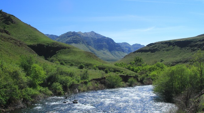
Reggie and I recently explored the Hells Canyon National Recreation Area – entering the area on the Imnaha, Oregon side and traveling down the lower Imnaha River – to within several miles of the Snake River. This trip was completed during late April in sunny, dry weather conditions. The area is located in the Wallowa-Whitman National Forest. A map of the area is here.
You can view the entire photography album here or here.
For the best viewing – please use a pc or a tablet. These images are very high quality and are not intended to be viewed on a mobile phone. When you get into an album – click on the first image and click “SLIDESHOW” for the best viewing. Enjoy!
From the town of Imnaha, Oregon — expect a 2+ hour drive to Cow Creek (see the map link above). The road from Cow Creek to Dugs Bar on the Snake River is for OFF-ROAD Vehicles ONLY — and expect ANOTHER 2+ hours to travel this segment (Cow Creek to Dougs Bar – see the map link above).
ALWAYS educate yourself if you are new to an area you desire to explore. ALWAYS study the postings at trailheads (typically from the U.S. Forest Service). Visit the U.S. Forest Service office BEFORE you depart on a hike. These folks are the resident experts on safety and suggestions.
PLEASE NOTE: Driving north out of Imnaha, Oregon (first left past the store) the pavement on 735 ends after a few miles. You will then be on a narrow, one lane, dirt road (FS 4260) – where you climb high above the lower Imnaha River. There is rock fall, scree, wildlife, oncoming vehicles and cattle on this road. Some turns are hairpin – very poor visibility of any oncoming traffic or rockfall around the turn. BE VERY careful. I would recommend a 4WD vehicle with high clearance, excellent brakes and equipped with tires designed for off-road – more than adequate for tough wilderness roads like this. FS 4260 is NOT a passenger vehicle road...PERIOD!!! DON’T even think about it!!! DRIVE FS 4260 VERY CAREFULLY – SLOW. If there is rain/thunderstorms in the forecast, raining or has been rain in the area during the previous 24 hours – plan to take this road another day where dry weather has made the road safe for travel.
The beauty you can enjoy from the heights (and dells) of this road are – unspeakable. There are NO GUARDRAILS on this road and 1,000 foot drops should you make a driving error. Be safe. Drive attentively. Go slow. Remember – when driving steep, rugged, off-road terrain like this – rockfall happens and you should remain aware of the up-slope rockfall possibilities as well.
Heat in the summer season can easily top 100 degree farenheit. Make sure you have LOTS OF WATER. (check your radiator, tires and AC before you go on this journey) Although the Imnaha River is inviting, you should have a good map as many parcels along the lower Imnaha are private property. THIS IS RATTLESNAKE COUNTRY! BE CAREFUL! Especially with pets and children. Yes, snakes require water too.


